

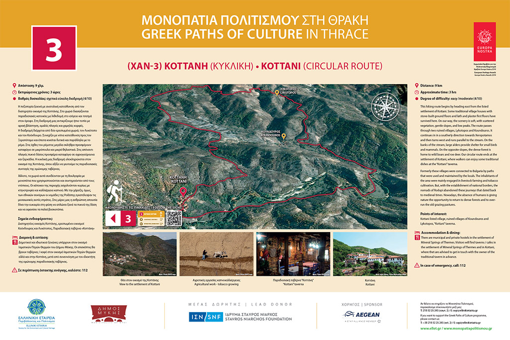
 9 km
9 km  3 hours
Degree of difficulty: easy (1/4)
This hiking route begins by heading east from the traditional village of Kottani. Some traditional village houses with stone-built ground floors and timber-built first floors have survived here. On our way, we see gentle scenery with scattered vegetation, smooth slopes, and low peaks. The route passes through two ruined villages, Lykotopos and Koundouros. It continues on in a southerly direction towards Xeropotamos and then turns to the west and runs parallel to the stream. On the banks of the stream, large alders offer shelter to small birds and mammals. On the opposite slopes, the dense forest is home to wild boars and deer. Our circular route ends at the settlement of Kottani, where walkers can enjoy some traditional dishes at the Kottani taverna.
At one point, these villages were connected to Bulgaria by paths that were used and maintained by the locals. The inhabitants of the area were mainly engaged in livestock farming and tobacco cultivation. But, with the establishment of national borders, the nomads of Rodopi abandoned these cross-border journeys that dated back to medieval times. Nowadays, the absence of human interference is giving nature the opportunity to return to dense forests and to over-run the grazing pastures.
Points of interest: Kottani listed village, ruined villages of Koundouros and Lykotopos, Kottani traditional Taverna
0